Active things to do (mostly outdoors), such as hiking, cycling, fishing, and birding, Also included are sightseeing excursions and visiting historic places.
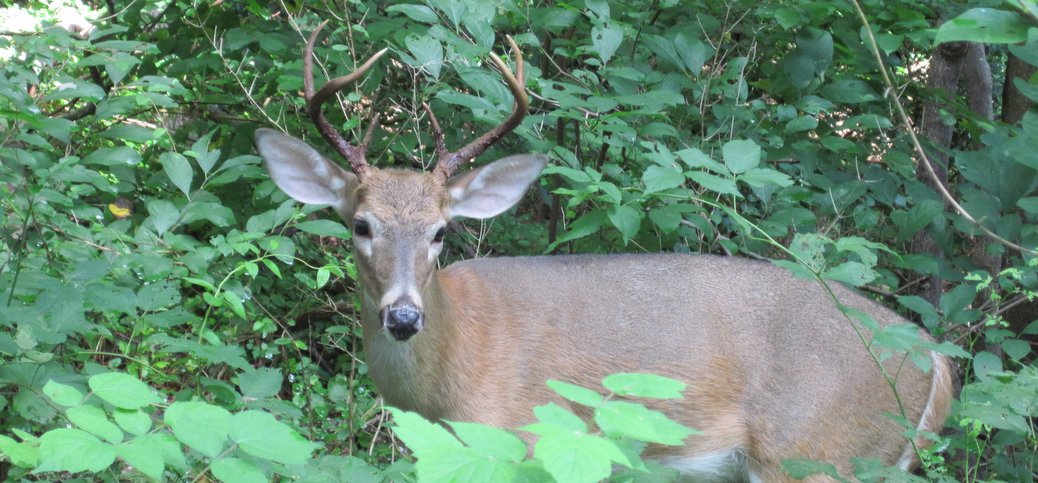
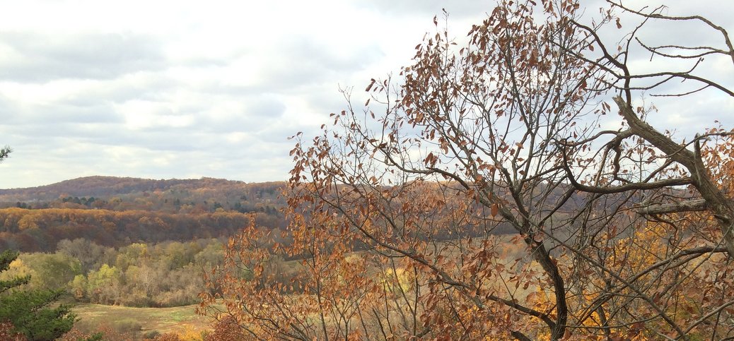
Hartshorne Woods is a magical place for walking or mountain biking (or fishing or birding), located on the highest coastal escarpment on the Atlantic seaboard south of Maine. A little over an hour from Trenton, east of Red Bank, and opposite Sandy Hook, it makes a wonderful half-day excursion in its own right, or combined with a half-day at the beach. Kids will love the lush terrain so close to the ocean, and the military anachronisms such as the WWII pillboxes (Driving time is about 75 minutes; Rated Intermediate for cumulative elevation gain)
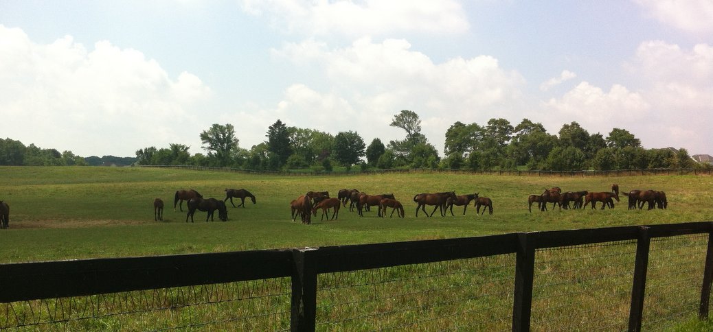
This is a 19 mile cycling route through rolling horse country which is about as good as it gets. If you’re an experienced cyclist, it’s the sort of ride that’s perfect to do fast. The pavement is great, there’s almost no traffic, and there are just enough hills to keep it interesting. For inexperienced cyclists, the rolling hills will be somewhat challenging, but not exhausting.
The goal was to find an outstanding road cycling route as close as possible to Trenton. It’s only 20 minutes away: starting at the Delaware and Raritan Canal Park parking lot next to the Washington Crossing bridge. With an extension, it’s about 21 miles (or you can cut it to 12 with a short cut and skipping the extension). Virtually all of the roads get very little traffic. None are ugly, some are downright bucolic with gorgeous horse farms and extended views.
This isn’t the most beautiful cycling route on this website. However, it is a reasonably pleasant 26.5 mile route that starts and ends within the City of Trenton. It’s a particularly good ride for someone who’s looking for a decent, regular training ride where you don’t want to take the time to drive to the start.
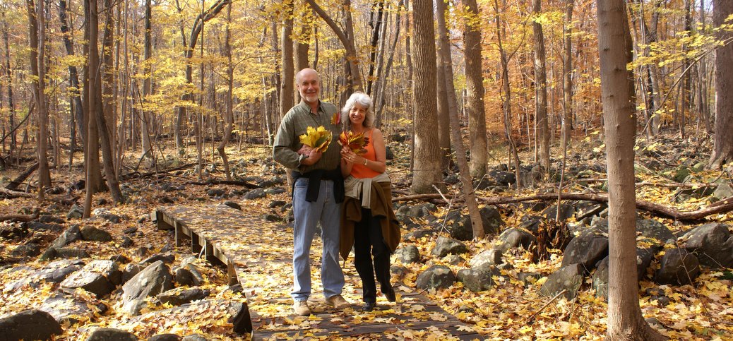
In recent years, Princeton has gotten serious about preserving open space. Recently, Princeton added Witherspoon Woods to its park system and trail network. It’s only 40 acres, but it adds charming terrain and a slightly more challenging way to access the Mountain Lakes Preserve. I stumbled upon it by accident and fell in love with it. A wonderful introduction to “real hiking” for beginners, and a charming walk for everyone. (Driving time is about 25 minutes. Rated Beginner though the footing is rocky in places and can get muddy in wet season)
Every year for 45+ years, Trenton’s charming, landmarked Mill Hill neighborhood spruces itself up and opens some of the most lovely homes in the neighborhood to perfect strangers. It’s an extraordinary opportunity to catch an intimate glimpse of urban living. Mill Hillians are a diverse and talented community, and the homes reflect their diversity of lifesytles, tastes, and expressions.
Goat Hill towers 400 feet above the Delaware River, and provides spectacular views of New Hope, Lambertville, and Bucks/Hunterdon counties. Local legend has it that Washington visited the site before he crossed the Delaware. Kids will love the views and will be intrigued by the history. (Driving time is about 25 minutes, Rated for Beginner to Experienced hikers, depending on where you go)
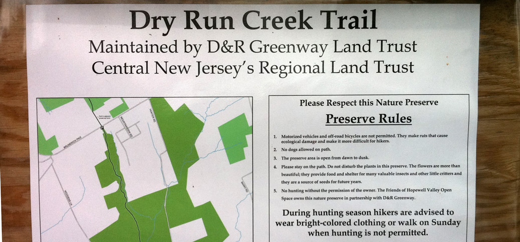
Just north of Mercer-Hunterdon County line is the Dry Run Creek trailhead, 20 minutes or so north of downtown Trenton by car. Maintained by the D&R Greenway Land Trust, it’s a delightful, 1.2 mile trail that descends into Dry Run Creek* and then climbs about 230 feet to 518 and another parking lot. There, if you look directly across the road, is the RockHopper Trail, which adds at least another 1.8 miles through the woods (Driving time 30 min or less; Suitable for Intermediate hikers due to elevation gain and occasional problems with trail blazes on the Rockhopper Trail)
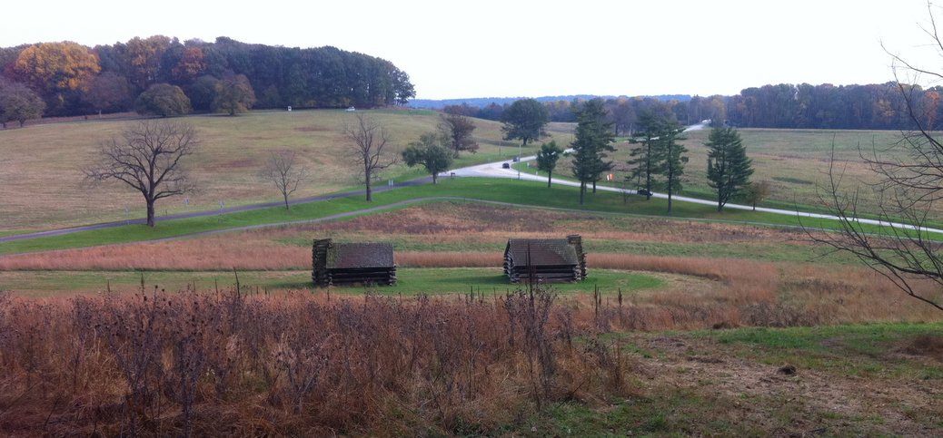
How do you feel about a 4 mile loop hike on one of the country’s most hallowed historic sites, just 45 minutes from town? Valley Forge is only about 40 miles west of Trenton. Kids will love Valley Creek, and the historical buildings. (Driving time about 45 min if you miss traffic; Rated Beginner to Experienced depending on the route you select)
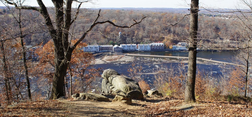
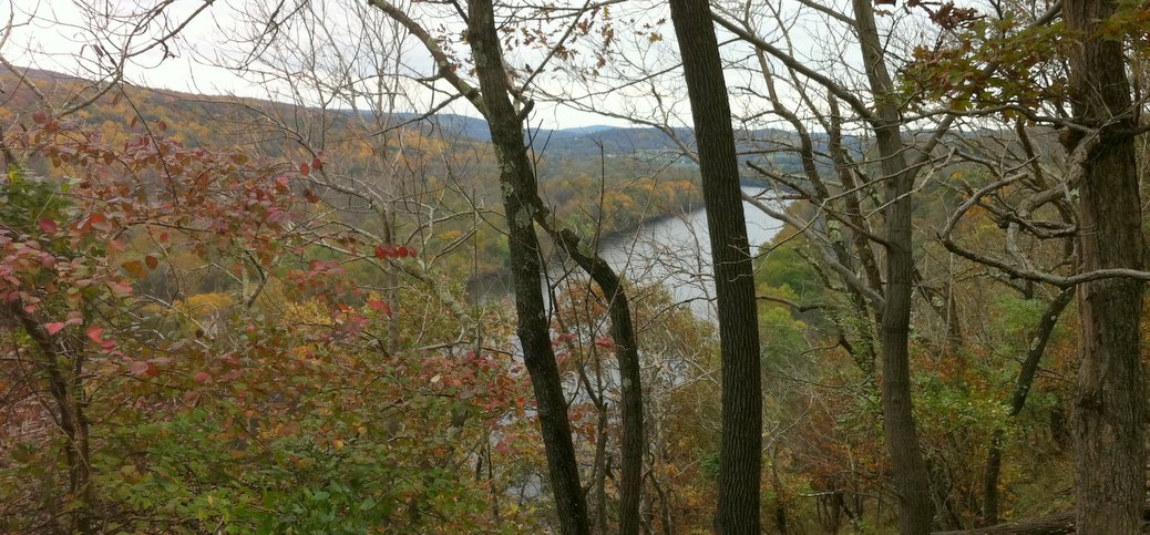
The Breden Preserve, 264 acres on Milford Bluffs, plus 30 acres preserved by the Nature Conservancy, provides a charming, and fairly easy walk to fabulous views of the river. (Driving time is 31-60 min, Rated Intermediate for elevation gain and because trails are poorly marked)
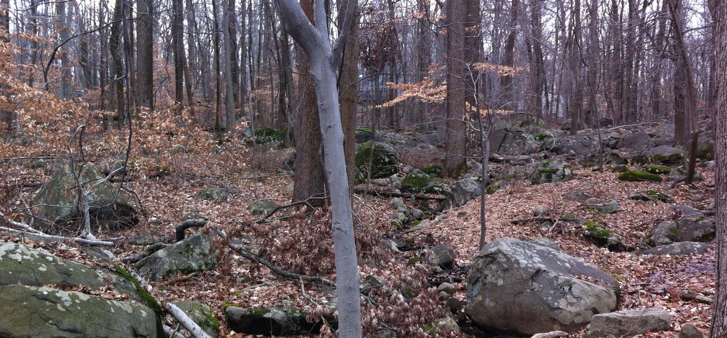
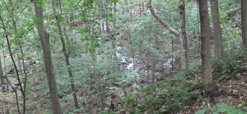
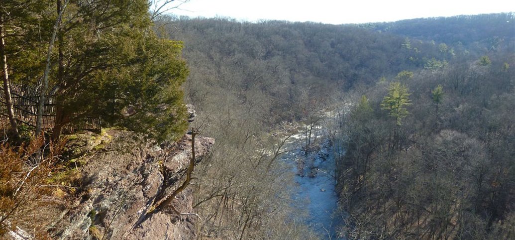
The preserve is great fun, with a fantastic loop hike at its core, which you can extend in various ways. There’s about 600 feet of cumulative elevation gain: some of the climbs are quite steep. There are also a couple of stream crossings. Usually you can just hop over stones to cross, but in high water, you may get your feet wet. (Driving time is about 75 minutes, though the drive, mostly on Rt. 29 is beautiful and stress free; Rated for Experienced hikers because of elevation gain and steepness)
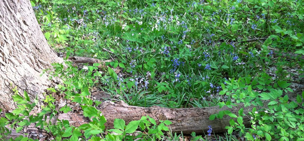
Bowman’s Hill has changed my life. Truly. If you read these pages at all regularly, you know I am an avid outdoorsman and hiker. But until I spent a couple of hours getting a guided tour of the Preserve in mid-April, I’d never focused on wildflowers. Now, whenever I go out for a walk (which is often) I can’t get them out of my consciousness. (Driving time is about 25 minutes; suitable for Beginner walkers)
This is a lovely ride through rolling countryside in and around Stockton and Lambertville. The Route passes within a 100 yards of the Woods Edge Wools Farm
This charming farm is located about a 30 minute drive north of Trenton. It makes for an incredible outing with kids to view the Llamas and Alpacas. Adults will find a visit fascinating as well, and will also enjoy the farm store which sells unique items, many hand made from the Alpaca and Llama wool. While not cheap, these items are priced lower than the equivalent quality in high end retail outlets.
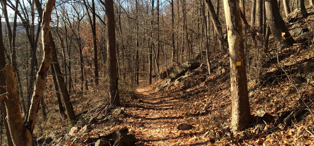
The Sourlands is one of the few hiking spots close to Trenton where you can experience reasonable elevation gain, second only to the Ted Stiles Preserve at Baldpate Mountain. Yes, it is about 40 minutes away (compared to Baldpate’s 20 minutes) and in the Sourlands you gain up to about 350 vertical feet on the steepest trail (compared to Baldpate’s 425). But, the Sourlands have miles of reasonably challenging forest-hiking trails to enjoy… There are trails suitable for all levels of walkers from Beginner to Advanced. Beginners can do some short loop hikes near the parking lot, while Intermediate hikers have miles of trails in the southern section with moderate grades. (Driving time is 40 min; Rated Beginner to Experienced depending on where you go)
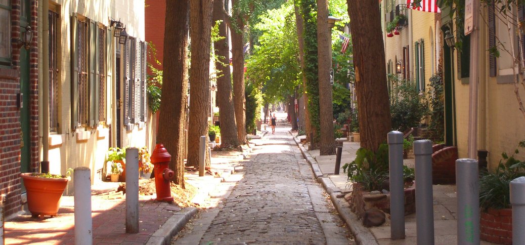
I suppose most people who live here, and many who are just exploring for the first time, know Trenton is located between New York and Philly. If, like me, you were NY focused before you moved here, you may not know that Philly is a) unbelievably close (34 miles, city center to city center), and b) a really, really cool place to visit.
The Switchback Trail delivers 425 vertical feet by itself, and you can achieve a cumulative elevation gain of nearly 1,000 vertical feet (well, OK, 950) by combining it with other trails. There’s no other walk of which I’m aware that delivers anything like that much vertical elevation gain within an hour’s drive of Trenton. Congrats to the Mercer County Park people for doing this. (Driving time is about 20 minutes; Rated Experienced for elevation gain)
If you’re like me, a marsh may not be the first place that comes to mind when you think of outdoor excursions (I generally think of mountains and trout streams), but then you’d be missing one of the most fascinating natural resources in the area. (Driving time is about 20 min; Rated for Beginner walkers, though be prepared for wet footing)
Every year since 1986, the Contemporary has sponsored tours of Trenton which provide an uncommon view of the city. The tours are fun, and will show you parts of the city you might never otherwise see. I happen to know 3 of the 4 guides in 2010 tour, and all are incredibly well qualified to conduct them.
The last few winters have broken records for southern NJ snow fall. For the first time in years, conditions have been more than adequate for cross-country skiing. Where’s the best place to go near Trenton?
Just 45 minutes from Trenton, across the river in Bucks county, is a spectacularly-scenic ridge-hike along Tohickon Creek. This is a moderately strenuous walk… most of the climbing (a couple of hundred vertical feet) is in the beginning along a well-graded road. To truly enjoy the hike, explore the side trails along the valley. (Driving time about 50 minutes; Rated Intermediate to Experienced, depending on how adventurous you feel in exploring the side trails)
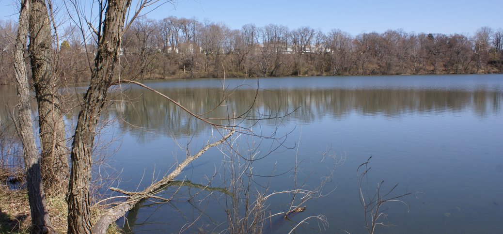
Little known, but open to the public, is a lovely pond and woods on the campus of the Institute for Advanced Study in Princeton, about a 20 minute drive north of Trenton. The pond supports solid populations of fish. It abuts the Institute Woods, which is transected by old woods roads which can be used as hiking trails (and cross-country skiing if there’s been a good snow fall) (Driving time is about 20 minutes; rated for Beginner hikers. Trails are flat and easy walking, though poorly marked. Be sure to bring a trail map).
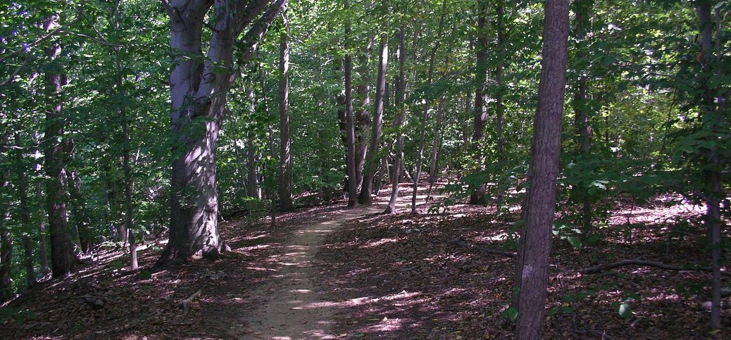
Utterly beautiful. 12 miles of hiking trails with up to a 400 foot elevation gain. 20 minutes from downtown Trenton. Need I say more? This is the jewel of the Mercer County Park system, and one of the nicest small parks in all of NJ. (Driving time is about 20 minutes; Rated beginner to Experienced depending on where you go).
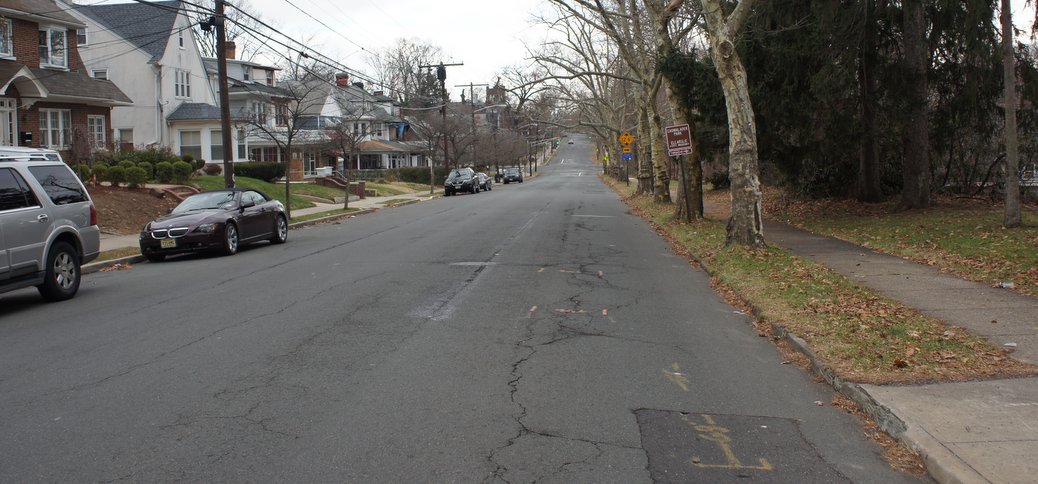
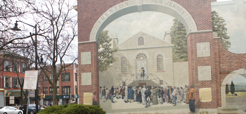
Warren Street is the center of the revival area of downtown Trenton. Go there to check out Classic’s Bookstore, the Big Easy or the Hummingbird, or to have a wonderful Italian dinner around the corner at Settimo Cielo. And while you’re there, it’s worth checking out the “revolutionary art” on Warren. (Rated for Beginner walkers)
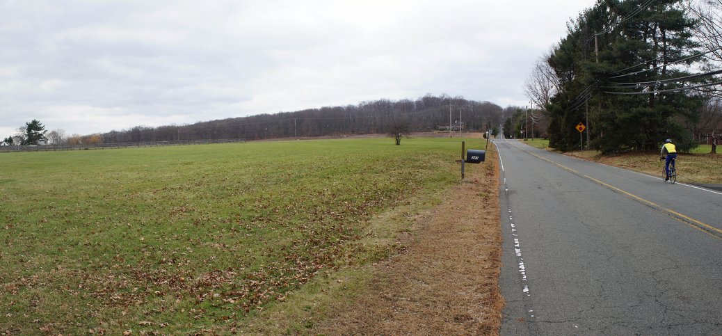
It still says “The Garden State” on our license plates, but in most parts of NJ it would really be more appropriate to say, “Suburban Sprawl State”. However, if you follow this ride, you may feel you’ve ridden through a time warp. While there is some recent development along the way, for the most part it looks like it did in 1960. And these roads touch on some of the most beautiful farmland and scenery you can imagine for Central NJ.
Part of the Monmouth County Park System, Clayton Park is an easy 25-minute shot from Trenton (off I-195 Exit 11). It’s absolutely lovely, featuring 8 miles of trails through a mixed habitat of mature hardwood forest, wetlands, and fields. The topography is rolling hills…there’s no more than a hundred feet or so of elevation gain at any one climb, but you can string together a few of those climbs to improve the aerobic value. More popular as a MTB trail than as a hiking trail, but both activites are lovely. (Driving time is just about 30 minutes, Rated for Beginner to Intermediate cyclists or hikers depending on where you go).
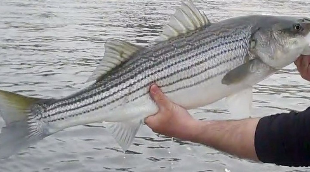
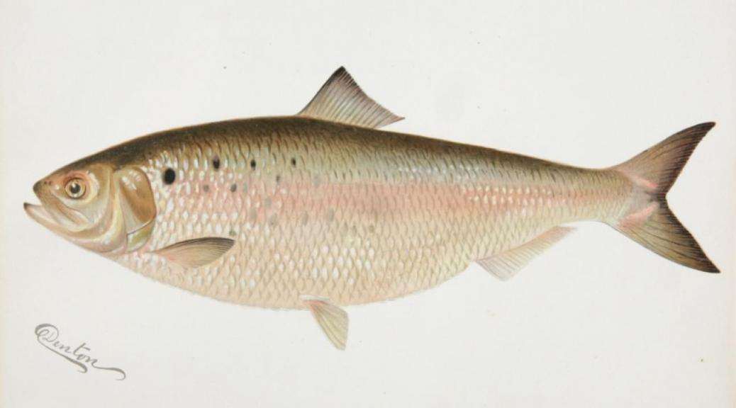
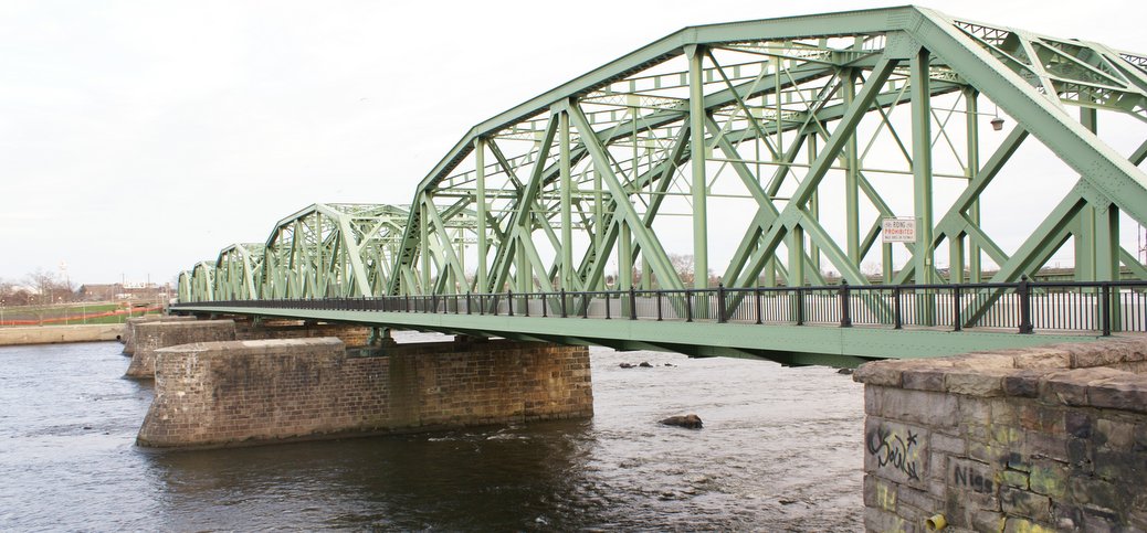
Striper season at Trenton will start as soon as the water warms up a bit. You need the water temp at or above 50 degrees to spark the bite…. Our best action has been in late April and all of May. You will know things are getting active when you see all the boats in the water fishing for herring right below the bridges and beside Kat-Man-Do.
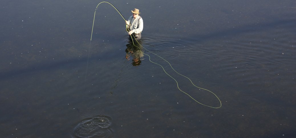
Spring through Fall, Trenton’s section of the Delaware becomes home to a nice population of smallmouth bass ready and eager to take your fly, lure, or bait. Fish up to a couple of pounds are pretty common, and larger is possible. There are also Carp, which can be HUGE, and are much harder to catch than the smallies.
Cycling out of the Delaware Valley into the rolling countryside surrounding Stockton and Sergeantsville, you could be forgiven for thinking you’d been beamed up to Vermont. It’s truly special. This is NOT a route for a novice rider. If you ride it all, it’s about 25 miles, and quite hilly.
OK, so it’s not exactly hidden, what with Six Flags being a major player in the “Location Entertainment” business. But it’s only about half an hour from Trenton. And what a lot of folks don’t know is they have a great “season pass” deal.
You can leave Trenton at 11 AM on the hottest weekend in August, and be comfortably ensconced on the beach long before noon. On the same day when your fellow New Jerseyans from, say, South Orange, are contemplating a 3 hour crawl through the world’s second longest parking lot (the Garden State Parkway – the world’s longest, of course, being the Long Island Expressway), you’re whisking from the terminus of Rt-29 to virtually the beach at 70 mph.
What’s the closest place to Trenton to get in a reasonable hike? The answer’s simple: Washington Crossing State Park (the NJ Park, not its counterpart on the PA side). It’s only about 8 miles from downtown, a straight shot up Rt. 29 (or you can cycle up the D&R canal, if you’re truly ambitious). (Driving time is about 15 minutes; Rated for beginner to intermediate hikers depending on where you go).
In a good year, nearly a million fish will pass underneath the Calhoun Street bridge. When the run is peaking, you’ll see dozens of boats anchored in the current, filled with fishermen hoping to hook into one. Many of the fish range between 4 and 6 pounds…and even a small one will give an angler a wonderful fight, especially on light tackle.
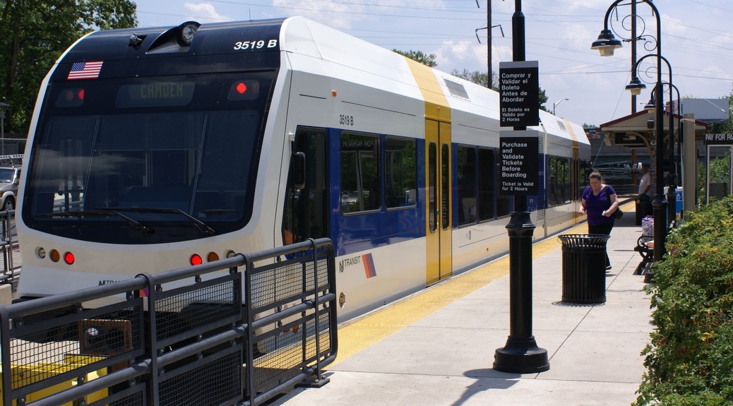
The River Line is the best way to commute via public transit from Trenton to Philly, and it’s a fabulous way to go on fun weekend excursions with the kids, including the Camden Waterfront.
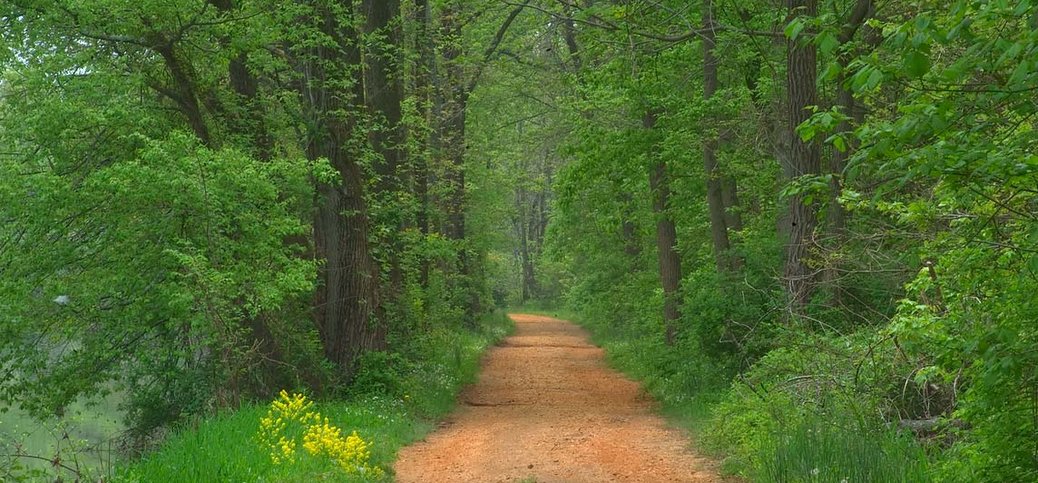
Riding a bicycle, walking the dog, or XC skiing in the winter, are all things you can do along the towpath of this superb “linear park”, which (with a few interruptions) connects Frenchtown to New Brunswick. It’s an easy ride on a MTB or hybrid, a bit more challenging (due to the occasional loose hard-pack) on a full-out road bike.
It’s the weekend, and you’ve been sitting like a slug for too long. You want a walk in the country, but your mother-in-law is coming over for dinner, and you’ve really only got an hour. What can you do? Walk the Levees! (No driving required as this walk is in town; Rated for Beginner walkers)