
Open year round, dawn to dusk
(609) 737-0609 Website Google Maps Trail Map (GR Series) Buried Treasure - 1896
Gravitas: ![]() Hiking:
Hiking: ![]() Proximity:
Proximity:![]()
Goat Hill Park was acquired in 2009 by the State of NJ, and is managed as a satellite park of Washington Crossing. It is potentially one of the most spectacular hiking destinations in central NJ, but budget and regulatory constraints have blocked the state from developing it. It’s a pity.
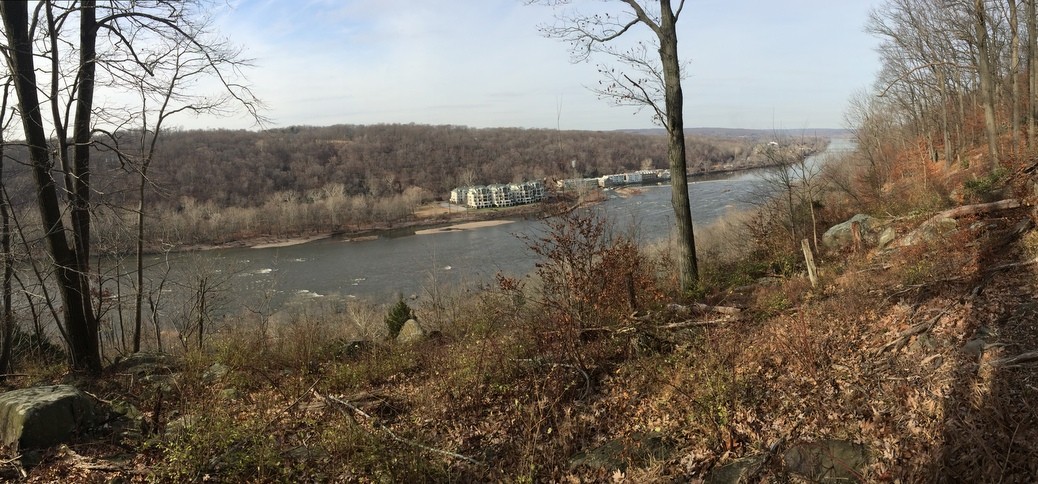
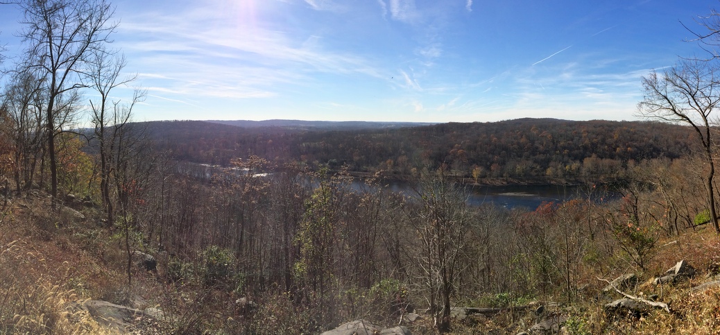
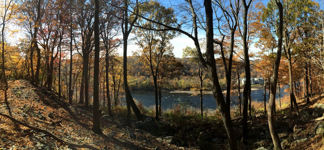
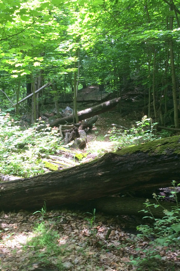
Of course, if you’re willing to bushwhack, you can still go exploring. The site boasts 5 spectacular viewpoints, only two of which are located on state-maintained trails. For the truly adventurous, there are slopes that can provide up to 400 feet of elevation gain, with gradients of up to 60% or so (i.e. really, really steep). It’s also, possibly, the site of buried treasure, though it was reported found in 1896 (see NY Times article). Was it all found? Perhaps not.
Let’s start with the understanding that exploring the back-woods of Goat Hill Park is something for mature, experienced woods people and is an inherently dangerous activity. Yes, you can follow the old woods roads, but they, by themselves, aren’t very interesting. The cool parts of the park are the stuff by the edge of the escarpment. This is where you find the views and the interesting geology (plus the remains of an old quarry). It’s also the place where, if you exercise poor judgement, you could find yourself in a serious pickle. There are several places that are truly exposed: where a fall could lead to a serious injury or worse. There are a LOT of places where you might need to do some boulder hopping. Then, if you slip, even if you just sprain an ankle, you can’t expect another hiker to come along and find you. None of the “trails” are maintained, blazed, or signposted. Needless to say, best to go with a friend. And explore within your abilities and fitness level. If you exercise good judgement, you can still have a lot of fun with minimal risk.
We’ve looked carefully for a route down to Rt. 29 through the old quarry site, and confess we haven’t found it (though we HAVE found references online from folks who claim to have done it). We’ve searched both from the bottom and the top, but every use trail we’ve explored has led to a dead end, or what appeared to be dangerous exposure. Be warned, and be VERY careful if you decide to explore here. If you know (or discover) the way, let us know: we’d love to be guided up the slope. Note that much less exposed routes down to paved roads are possible towards the southern end of the park. Even that requires some serious boulder hopping. However, you can’t get all of the way to the roads without crossing private lands (which all appear to be posted).
Also, despite being the top of a mountain, significant parts of the park are wetlands, and can get very wet and muddy at certain times of the year. Several parts of the “backbone” woods road get especially wet.
The best time for serious exploration is when the leaves are down and the brush is dormant. Probably the best time is November, after the first frost has driven away most of the ticks, when it’s usually dry, and before you need to worry about ice. Early spring is OK, too, but then you’ll want ankle-high waterproof boots, and gaiters to keep mud from slopping over the top.
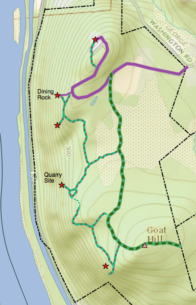
The attached GR series map shows all of the existing woods roads (which are overgrown to various degrees) plus MOST (but certainly not all) of the “use paths” you’ll run into. Note that this map was created based on tracks captured using a handheld GPS. These have an error of up to about 50 feet, so that if your GPS errs 50 feet in one direction, and our map has an error of 50 feet in the other direction, the path might be 100 feet from where your GPS says it should be. That may not sound like a lot, but given that these paths are usually quite narrow (typically a slightly eroded line a few inches wide), it can seem like a long way on the ground.
The use paths generally are pretty easy to follow IF you know how — but even experienced hikers who are used only to well blazed trails may find them difficult to follow at times. If you lose the path, stop for a moment and look around. If you don’t see the trail, keep going in the general direction indicated on your GPS, scanning the terrain left and right. Most of the time you’ll spot the track within a few dozen feet. Worst case, make your way back to the “backbone” woods road: it’s quite distinct (relatively speaking, though it’s still overgrown) along its whole length.
If you intend to bushwhack during tick season, be sure to take serious precautions… Much of the brush has thorns and other nasties, so leave the shorts home and wear canvas or nylon pants to give your legs some protection.


