
When there's snow cover, generally dawn to dusk, though check for closings during hunting season
Gravitas: ![]() Proximity:
Proximity:![]()
OK, it’s winter, and we just got a big slug of snow. It would be wonderful to go XC skiing… Where’s the best place to go?
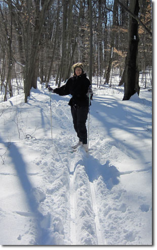
Virtually all of the parks we list for beginners hiking can support cross country skiing. None groom trails or set tracks, so you’re on your own in that department. Best is to go in a group, so you can share “trail breaking” work. Of course, often, you can ski in the tracks of someone else, making the experience more pleasurable, even for the lead skier. Note that NONE of the parks is specifically set up for XC skiing. PLEASE EXERCISE CAUTION. As with any ungroomed trail, there’s the potential for buried obstacles that can trip you up, and for bald patches that you come upon suddenly. Trails can narrow without warning, and descents can be treacherous. SKI AT YOUR OWN RISK.
For me, the two best places to go are Baldpate Mountain and, especially, Clayton Park. For novice skiers, the Institute Woods in Princeton is excellent, and heavily used, as is the D&H feeder canal near Washington Crossing State Park.
The Institute Woods are part of the grounds of the Institute for Advanced Study. Trails run behind the Institute Pond, which is the main summer attraction of these grounds, IMO. A reasonably good trail map can be found here. All of the trails are basically flat.
Recently I discovered Tyler State Park in Newtown, PA, only about 25 minutes from Trenton. It has dozens of miles of equestrian and multipurpose trails through rolling terrain that would be great for skiing. This winter I’ll check it out and hopefully expand this review.
For Baldpate, once you’re on the ridge, you can readily ski along the backbone white-blazed trail for several miles. Your best access point is probably off of Fiddler’s Creeek Rd. When I visited recently, the parking lot wasn’t plowed, but the road up the hill was, all the way to the buildings near the top (probably for insurance reasons, which suggests it will reliably be plowed after every snowfall). So you can park up there and strap on your skis, with only a short climb across the pasture to get to the ridge. Alternatively, you can park at the Pleasant Valley parking lot (if it’s plowed), which is located at the beginning of the white-blazed trail. You can download a Baldpate trail map here.
Novice skiers on Baldpate should probably stay on the open pastures. The white blazed “backbone” trail is good for intermediate skiers, as there are some hills, though relatively gentle turns. The trails which come off the backbone ALL involve significant elevation changes suitable only for reasonably accomplished back-country skiers. Especially the Summit (blue blazed) Trail and the Switchback (Yellow Blazed) trail, will be too steep for anyone but an expert. The Summit Trail also involves some rocky, scrambly bits that would require a VERY deep snow to cover, and then only by experts. Both trails, however, are fun to tackle with snow shoes.
 As nice as Baldpate is, Clayton Park is the best spot, in my opinion. It offers varied terrain, and essentially every trail is ski-able for skiers of varying skill levels, from beginners to expert (and for fearless moderate skiers).
I’ve attached a ski-trail map to aid your route selection. See: Clayton Park Ski Map. Note, there is no substitute for you exercising judgment, and there’s no shame in walking or side-stepping down a trail that may be at the limit of your abilities. Also, keep in mind that what might be a “beginner’s” trail in normal conditions, might require expert skills in others (say if it’s icy). So use your common sense.
- The fields on the western end of the park (marked in a mustard green) are slightly rolling, but generally offer little or no obstacles. They are perfect for beginners. The ups and downs offer just enough challenge to improve skills.
- The trail marked in blue is for “advanced beginners”. Note there will be short sections of the trail which may be beyond your skill level. So be prepared to side step down, or pop your skis off. However, none of the steep sections is longer than a dozen yards or so, and most of the terrain is gently rolling to flat. The trail starts on the open farmland, descends into the woods (the most challenging part of this trail), and then opens up again as you approach the pond. Past the pond, it’s mostly gently rolling terrain on woods roads, with a couple of short, sharp hills that you may need to negotiate off ski. Elevation gains or losses for individual hills are limited to 20 to 30 vertical feet or less (though cumulatively, you’ll descend 100 feet or so from the parking lot to the pond, mostly in the woods, with gentle descents between “steep” parts).
- The trails marked in magenta are similar, but have slightly more elevation gain and loss. I wouldn’t attempt them unless you feel confident in your ability to both climb and turn on descents. Individual elevation gains are up to 75 vertical feet or so.
- The trails marked in red require greater expertise still, and have hills with elevation gains or losses in excess of 100 feet.


