
Maps that Show you Where You Are!
Free, and exclusive to Hidden Trenton!
If you like the maps, please thank us by “Liking” us on Facebook…
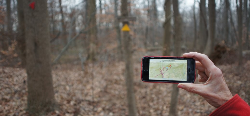
Ever go hiking and wish you’d brought along a trail map? Or worse, you have a printed map with you, but you’ve not been paying attention. And now you’re kind of lost, and aren’t quite sure where you are on the map? For me, the answer would be yes and yes.
Well, if you have an Iphone or Android smart phone, you’re in luck.
You can tell which of our trail maps will work in a phone, because we added “GR” (for georeferenced) to the end of the filename. These maps are specially encoded PDFs.
Load them into a free app called Avenza Maps, and they’ll display in your phone with your current GPS location. (They also print just fine: they’re tabloid size, but Acrobat will reduce them automatically if you print them on letter-sized paper). Installation instructions follow below the download links…
Click on the links below to download each map
BaldpateGR
Clayton Park GR
Goat Hill Bushwhack GR
Hartshorne Woods GR
Levee WalkGR
SourlandsGR
Washington Crossing GR
Witherspoon-Mountain Lakes GR
Installation instructions
IOS and Android have both made installation much easier than it used to be. For quick installation on an iPhone, follow these instructions, or see the links below from Avenza’s webiste for iPhone and Android:
- On your phone, click on the download links above for the map(s) you want. Note that the free version of Avenza Maps will limit you to at most 3 maps active at one time (you can delete and add maps later if you run into that limit). Your phone will save those maps to a file folder, probably “Downloads”
- Go to the App Store (iPhone) or Play Store (Android) and install Avenza Maps.
- Once it’s fully installed, go to the “My Maps” tab by clicking the icon at the bottom of your screen
- From the My Maps tab, click on the plus sign on the top bar. This opens the Import Map dialog
- Select “From Storage Locations”
- Navigate to your default downloads folder, probably “Downloads”
- Click on the map you want to import. Avenza maps will upload, then process the geographic information, so it may take a minute or so.
- If you want to upload another map, repeat from step 4.
For more information, check out these instructions on the Avenza website: iPhone instructions | Android Instructions.

I used the Baldpate Mountain map today. Thanks for the great resource!
Wow! I tried out the Baldpate map yesterday. Installation went like a snap, and the map is incredibly accurate. I was able to explore parts of the park I’ve never tried before. Every trail junction showed up, bang, right where it was supposed to be. Thank you so much! I just liked Hidden Trenton on Facebook.