
Open daily, sunrise to sunset
Google Maps Trail Map (GR Series)
Gravitas: ![]() Hiking:
Hiking: ![]() MTB:
MTB: ![]() Proximity:
Proximity:![]()
Compared to other parks in the area, the trails make for more rugged walking, because they are generally purpose built for hiking (not converted woods roads), and are quite rocky (though beginner trails have been fairly well graded). After the Sourlands and Baldpate, the next closest hike with a higher elevation gain is half an hour further away. So it’s a spot you may want to check out if you enjoy hiking. Combine it with a stop in Princeton on the way out or back and you’ve got a lovely excursion for an afternoon in the “country”.
Operated by the Somerset County Park Commission, the trails are well maintained and marked. While you occasionally share the trails with mountain bikers, the paths are quite rocky, making it a highly technical ride, and discouraging most bikers. The trail comments below refer to notes on the Somerset Country brochure, reproduced below (note North is to the right, West is up on this map).
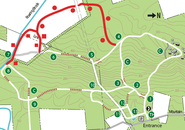
The park has recently opened up a number of new trails, and relocated a major segment (signposts 6-7-8). These are marked in red and gray on the map. While the scale isn’t obvious, the trails along the outer loop are about 10 miles, although the system allows walks of all distances and difficulties from moderately easy to moderately strenuous. You can divide the park into trails to the North of the gas pipeline (which is shown as the double dashed lines in the center of the map), and those South of the pipeline. The northern trails, by and large, are steeper and more rugged. The Southern trails are generally more open and longer, well suited to “Intermediate” hikers. Roaring Brook is also in the southern end of the park, which is pretty when it contains water. The pipeline right of way is walkable. It’s one of the steeper ‘trails’ in the park, and allows you to create multiple variations without spending hours in the park.
My favorite walk in the park stays in the north (see map). It follows the main trail along the right-most, northern segment (1 to 4, blazed with white squares). However, I prefer the connector trail near the northern tip of the trail system (This trail is blazed with a white circle surrounding a black C, and is shown on the map as gray). This is just about the steepest section of trail in the park. After it connects back to the white trail, I continue left and stay straight at signpost 4. After a few dozen yards, I turn right at the new, red-circle blazed trail and follow it to the pipeline (top of map). I then turn left, heading east along the right of way, then cut back left at signpost 5 onto the main trail (blazed with white squares), follow it back to signpost 4, and descend on the “Connector” trail (also marked on the map with a C, and on the trees with a white circle surrounding the C), past signposts 3-2-1, down to the parking lot.

There’s one panoramic view in the park, where the main square-blazed trail crosses the gas pipeline right-of-way, near the spot marked 5 on the map. On a clear day you can see lower Manhattan.
There’s also a pond which is stocked with sunfish and bass…it gets an awful algae bloom in summer, but for a couple of months between April and June it’s pretty good fishing.
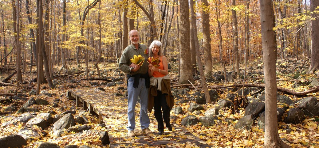
BTW, the couple in the banner photo is my brother and sister-in-law. They live in Marin County, and hike all over California. They LOVE the Sourlands with its trees, leaves, and boulders.


