
Open dawn to dusk year round. During hunting season (Dec-Feb) there are usually closings W-Sa.
(609) 989-6559 Website Google Maps Trail Map (GR Series)
Gravitas: ![]() Hiking:
Hiking: ![]() Proximity:
Proximity:![]()
In 2010, the Mercer County Parks folks opened up a new trail (dubbed the “Switchback Trail” on the latest trail map) in the Ted Stiles Preserve at Baldpate Mountain, which enables the most aerobic walk in the area. Ascending 425 vertical feet in around 6/10 of a mile, it achieves the greatest vertical gain of any trail in Mercer County, and the steepest average gradient. By comparison, the Summit Trail in Baldpate Mountain (Blue Blazes) delivers 325 vertical feet in around 1.2 miles (it starts about 100 feet higher). From the parking lot to the ridge in the Sourlands Preserve (which is Somerset County, and an extra 20 minutes away) is also only about 320 feet, and not nearly as steep. We’ve rated this walk for Experienced hikers due to elevation gain, though fit Intermediate walkers should have no trouble completing at least part of this route.
By combining the climb up on the yellow-blazed Switchback Trail with a descent down the park road, a climb back up the Blue Blazed Summit Trail, and the north loop on the Red Blazed Trail of Baldpate Mountain, you can achieve a cumulative elevation gain of nearly 1,000 vertical feet (well, OK, 950) in a 90 minute walk. There’s no other walk of which I’m aware that delivers anything like that much vertical elevation within an hour’s drive of Trenton. Congrats to the Mercer County Park people for doing this.
Unfortunately, they haven’t done much about making it clear where to go or park. The Yellow Blazed trail originates on the edge of a field that is just south of the Great Bear Nursery (formerly Brymer Nursury) at 1600 River Rd (Rt. 29). As of the date of this updated review, October 2013, there is still no signage for parking, though there is now a bulletin board and trail map at the trail head. A mowed path takes you from the parking area to the beginning of the trail itself, which is an old woods road.
To get there from Trenton, drive up Rt. 29, 6/10 of a mile north of Fiddler’s Creek Road. You’ll see a beige stucco house with blue trim on your right (photo 1).
The house is empty and is part of the Preserve. Pull into the driveway just before the house, and park your car (photo 2). [If you’re driving south on Rt. 29 to get here, look for the Great Bear Nursery on your left. The Stucco house will be the next building you’ll see.]

An aerial view of all this (which is actually now quite simple if you know where to park) is shown below.

What follows are directions for the full walk, which is probably 5 miles and takes a little less than 2 hours, depending on your fitness. Once you learn the trail system, you’ll find variations which take as little as 40 minutes. Make sure that you download our GR Series Map, and follow the directions to install it on your phone. It will allow you to track your progress taking advantage of its built in GPS chip. Note in the illustration that follows, that trail placements on are approximate, though the trail intersections should be reasonably accurate. (At some point I’ll update this to reflect our latest map which is precisely to scale, but you pick your battles…)

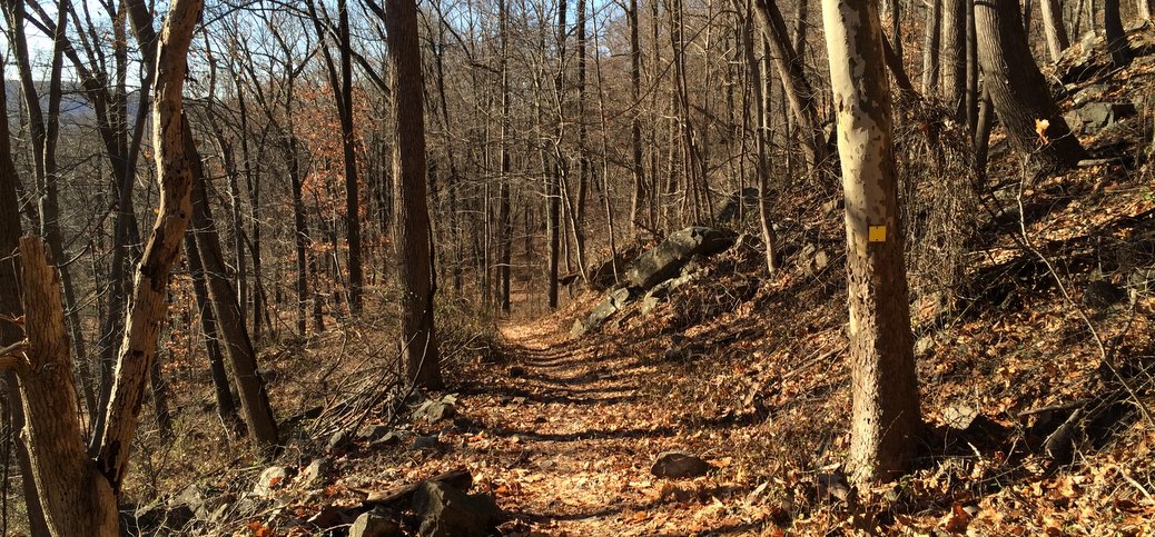
Generally, the Yellow Blazed Trail is pretty easy to follow. There’s the potential for a little confusion in the first few hundred feet as some other woods road merge in, and the blazes aren’t always obvious. Just follow the widest trail, and make sure you see a yellow blaze within a hundred feet or so (if not, you may have made a wrong turn).
The trail climbs steeply, then eases a couple of times. At the top, you join the end of the “Red Blazed Trail”. Make a right, and then, 50 feet later, make the left onto the “White Blazed Trail”. Within a minute or so, you’ll find yourself on a meadow, climbing gently towards a large Honey Locust tree. The “summit” of Baldpate Mountain is just beyond (note the brass marker). The County mows a path from the summit down towards the fence and park road. Make the right onto this path. When you reach the fence, stay right until you go through the gate onto the park road. (Variation: loop back on the white blazed trail on your right, instead of the road, and then return directly via the red and yellow blazed trails. This makes a short, sharp 40 minute walk).
Continue following the road down, nearly to Fiddler’s Creek Road. Just before you exit, you’ll see the parking lot 50 yards to your left. Head towards the parking lot, and you’ll find that you’re on the “Summit Trail” which is marked with Blue Blazes. Make sure you make the sharp left to stay on the Blue Blazed Trail (it’s easy to miss the turn, and end up at the Pond). Follow the Summit Trail all the way back up to the Park Road, an elevation gain of about 300 feet.
Make a right onto the Park Rd, then another right when you hit the White Blazed Trail a hundred yards later.* Follow this woods road along the meadow. Immediately past the meadow make a left to descend on the Red Blazed Trail. Make sure you follow the Red Blazes to the left. Once you make the left, the grade will ease considerably. You’ll continue straight for 10 minutes or so, then start climbing after the trail makes a sharp turn to the left. The Red Blazed trail adds about 225 vertical feet to the walk.
Once at the top, make a left, and then look for the Yellow Blazed trail on your right, just a few yards along. Make a right to descend the Yellow Blazed Trail and retrace your steps back to your car.
*Variation: you can skip the Red Blazed section by continuing straight on the blue blazed summit trail across the road. It will take you, within 2 or 3 minutes, back to the summit, where you can reverse your route back to the car. This variation is a tough 75-80 minute walk with 750 vertical feet of cumulative elevation gain. Indeed there are multiple variations possible, incorporating the pond trail, for example. So you can walk the area frequently without getting bored.


Could be a very nice hike in dry conditions. Tried it out in February 2018 (a very wet month), and the mud was really bad. The yellow and red paths were lined with overgrown briars so it was not possible to step off the path and go around the mud. We will gladly return if there is a dry spell (warm weather) or a very cold spell (so that the mud is frozen).
Many trails in Baldpate are subject to mud in wet conditions, though some drain better than others. In particular, the Yellow trail you mention has a stretch that drains poorly not far from the trailhead. If you wear over-the-ankle, waterproof boots, you can slog through the mud and not get your feet wet (although not everyone likes to slog through mud. I don’t mind). And if there’s no snow cover, and a few days with no rain, the puddles can dry up nicely. On the Red trail, there’s a patch where (in wet season) springs seep over the trail. It is muddy in those patches, and is more seasonal and less dependent on recent precipitation. The trails in the eastern end of the park can be even wetter. Personally, I beleive that if you hike anywhere in the east in February, during a thaw, you have to be prepared for mud.
Thank you for the excellent hiking guides, especially this one. This is not only a great workout, but incredibly fun! The full rock scramble (think it was part of the blue trail) was an unexpected treat and there was an amazing view of the woods just up past the scramble to the left.
No question about it, this is the best hiking in Mercer County! My wife and I have been hiking Baldpate since we discovered it back in December, and we hike more often now since hunting season is over. In addition to the trails shown on the map, there are several trails not shown that connect to these, and they are excellent as well. The various combinations of trails always makes for an interesting hike. The Mercer County Park Commission has a real winner here!
Thanks for this suggestion. I recently discovered this park and it is the best hike in Mercer County. Kudos to Kevin Bannon and the rest of the staff at the Mercer County Park Commission. They are doing a great job making available a lot of great outdoor opportunities here.
Thanks for the 411! For a long time, there were no real quality or lengthy hikes in Mercer County. The explosion of open space preservation in Hopewell Township has changed this, and now I am glad to see this new system (well, relatively new) to add to better hiking closer to home. And the added parking information you give is golden, its almost impossible for someone to figure out how exactly to access the Baldpate mountain trails. Good work!
Thanks for your excellent description of this wonderful place. My wife and I had hiked the mountain a couple of years ago, but we could not remember how to access it, and, as you point out, the park system does not make it clear. We’ll be up there soon!