See riding addreses in review: Canal open dawn to dusk year round
(609) 924-4646 Website Google Maps Feeder Map Park Map
Gravitas: ![]() RDB:
RDB: ![]() MTB:
MTB: ![]() Proximity:
Proximity:![]()
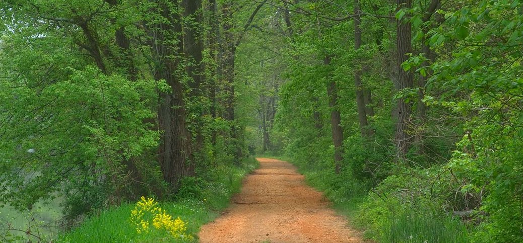
Riding a bicycle, walking the dog, or XC skiing in the winter, are all things you can do along the towpath in this superb “linear park,”, which (with a few interruptions) connects Frenchtown to New Brunswick.
Originally, the D&R canal connected the Delaware and Raritan valleys to barge traffic. It facilitated commerce between Philadelphia and New York, and allowed lumber, blue stone, and other Catskill products on the Delaware drainage destined for NYC to avoid the long sea journey around Cape May. Built between 1830-34, the main canal ran from Bordentown to New Brunswick. The “feeder” canal started in Frenchtown, and ensured ample water supply for the main canal at its highest point in Trenton.
The canal is now a state park, although the D&R Greenway Land Trust is responsible for managing its preservation. There are 22 miles from Ewing north to Frenchtown; and some 36 miles from Trenton to New Brunswick. For most of this distance, it is a public right of way, closed to motor vehicles, with a hard pack, gravel tow path. It is passable to bicycles over virtually this entire distance. Any hybrid or mountain bike will easily negotiate the trails; even road bikes are OK (albeit a little freaky in spots, which is why we rate it “Intermediate”). The section of the canal near Washington Crossing State Park is also popular for X-C skiing when snow cover is sufficient.
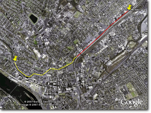
Within the City of Trenton, the canal gets chopped up badly. You can, in theory, ride along the feeder canal through much of the city but, in practice, it’s not worth it. The feeder canal is marked in yellow on the photo below. It ducks into a culvert just before it reaches Southard Street, and runs underground (red line) until emerging again at Mulberry. So you can’t ride along THAT part of the canal even if you want to.
The two USEFUL points of access are marked on the photo above. You can hook up with the canal at Prospect Street and West State Street (Directions) if you want to ride along the feeder canal to Washington Crossing and the northwest. Or you can pick up the Main canal at Mulberry Street, just beyond the Salvation Army building (Directions), and head northeast to Princeton and beyond.
Access to the canals is generally straight forward, but be-warned that there is a lot of broken glass on the city streets. If you ride much in the city, you probably have kevlar-belted tires on your bike, and they make a huge difference. If don’t do a lot of city riding, and are using standard tires, make sure you have spare tubes, tire irons, and a pump with you. You may well need to change a flat (also, make sure you pull any glass out of the tire before re-inflating it, or you’ll just puncture again immediately).
Once you get on the towpath itself, it’s a fun ride, since you need to worry about cars only when you cross roads. The state completed a bicycle overpass across Rt. 1 a few years ago, completing the last gap in the path all the way to the outskirts of New Brunswick.
Activities | Cycling-MT | Cycling-Road | X-C Skiing


Thanks for the info regarding the canal path. I plan to bike on the path from Bull’s Island to New Brunswick this spring and was wondering how to maneuver through Trenton as I heard part of the canal goes underground.
You can access the canal path from Cadwalader Park, too. I just went for a nice jog there last weekend. It’s beautiful, it’s nature, and it’s in Trenton.