Website Google Maps
Gravitas: ![]() Hiking:
Hiking: ![]() MTB:
MTB: ![]() Proximity:
Proximity:![]()
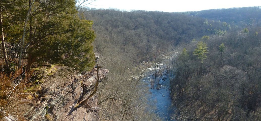
Just 45 minutes from Trenton, across the river in Bucks county, is a spectacularly-scenic ridge-hike along Tohickon Creek. This is a moderately strenuous walk… most of the climbing (a couple of hundred vertical feet) is in the beginning along a well-graded, paved road. The trail itself (especially the red trail) offers some ups and downs, but is mostly level. In the fall and winter, with the leaves down, you walk in continuous views of the creek, and of the hills on the opposite side of the valley. In places (marked with the “camera” on the aerial photo), the trail overlooks steep cliffs, where you can get a clear view of the creek, as well as hawks perched on the ledges and flying along the valley. To find a more scenic hike, you’d need to drive at least another 45 minutes further. BTW, Google Maps claims this drive is 1 hr 15 minutes “in traffic”. But it took me precisely 46 minutes (without speeding) on a recent Sunday, from Trenton’s Mill Hill. If you live in the west ward, it will take even less time.
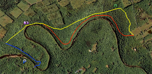
The hike starts in Ralph Stover State Park (P), which has ample free parking. It is on the opposite bank of Tohickon Creek, a medium sized stream that cuts a deep valley as it wends its way to the Delaware. You cross a bridge (open only to pedestrians and bicycles), and walk up the road a quarter of a mile or so (marked blue on the photo). 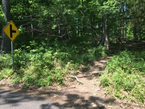 As you near the crest of the hill, a couple of hundred yards before the intersection with Tory Rd, just before the warning sign, you’ll see a distinct trail heading into the woods, though at our last visit, (May 2015) the yellow painted blazes had nearly faded. This is the trail. You’ve now entered Tochickon Valley Park, which is maintained by Bucks County (marked yellow on the map).
The trail climbs gently through the woods for the first 5 minutes of so. After after another 5-10 minutes you’ll start to see signs for viewpoints. By all means stop and take in the views. This is the so-called “High Rocks” area. Even fairly agoraphobic walkers will feel secure standing near the cliff edge behind the heavy, wrought-iron fences.
Once past the the High Rocks area, the yellow trail will continue along the top of the ridge. While the yellow trail is fairly pretty, and easy to walk, it’s not nearly as attractive as the alternate trail(s) (red in the photo) which runs closer to the creek, below the ridge crest, traversing the valley walls. This trail (which appears to be the original hiking trail laid out here) used to be blazed with painted red circles, but these have completely weathered away. Still, there’s more than enough hiker and MTB traffic to keep these trails clear.
Unfortunately, this trail isn’t marked at all where it initially diverges from the yellow-blazed trail. In addition, you’ll discover there are often several parallel, unmarked side trails which might confuse beginner or intermediate hikers. If you stick to the Yellow blazed trail this is an Intermediate Hike; the “Red” trail, and the side trails are for more experienced hikers.
To get onto the “Red” trail, look for a trail going off to the right, just as the yellow trail turns away from the valley walls. It’s a few minutes past the last High Rocks sign. Unfortunately, it’s NOT the first trail to the right. You’ll pass a couple of unmarked trails to viewpoints first, which typically loop back to the main trail. The beginning of the “Red” trail looks similar to these others, though it’s a bit wider, parallels the ridge, and keeps going. You’ll know you’ve gone too far on the Yellow trail if you find yourself on top of the ridge, well away from the sloping valley walls. Just double back and look for the trail descending slightly lower along the ridge. It’s really much nicer.
Taking the “red” trail in both directions is recommended (the views are different and the walking more interesting), unless you’re tired, in which case you might want to walk out along the red trail and return via the yellow trail, which is wider and flatter. To find the yellow trail on your return from the campground, just follow the campground paved drive. You’ll start to see yellow blazes even along the asphalt, which will continue after the pavement ends. Alternatively, at any point you can just turn around on the red trail. There are several points where the two trails run close together (and several places where well-worn use trails connect the two paths).
Note, as you walk through the woods along the “red” trail, there’s one place where there is a wide, well graded trail all the way down to the water. 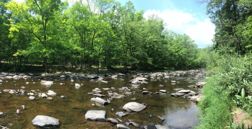
In addition, if you follow the “red” trail, you’ll come to a spot where the trail splits: the slightly wider path will head uphill, to parallel the river mid-way up the ridge, the slightly narrower path descends gently, and parallels the stream much closer to the water. There are a couple of places further on where paths connect the two (some of which are quite steep). NONE OF THESE TRAILS ARE MARKED OR SIGNPOSTED. However, if you always stay in contact with the river, and keep it on your right shoulder heading out, and on your left returning, it’s pretty hard to get lost, so feel free to explore. Eschew the narrow or super-steep side trails: most of the wider trails go through and connect in ways that shouldn’t confuse you too much.
If you walk fairly quickly, it could take you 2-2.5 hours to complete this hike to the far campground and back. Of course, if you stop to take in the views, or eat a picnic lunch, it could take longer. The campground at the far end offers picnic tables, so it’s a logical place to eat (though big stones on the stream provide natural seats and picnic areas as well).
The trails, especially the yellow trail, are suited for mountain biking, if you’re a fairly proficient rider.
You might want to hike with a fishing rod. In the spring, the Tohickon is stocked with trout. In the spring and summer, it offers pretty good smallmouth fishing. You can fish in Ralph Stover Park (recommended during stocking season, though there will likely be others around), or you can carry the rod along the trail. There’s one point in particular where the Red trail descends to perhaps 50 vertical feet of the Tohickon, an easy bushwhack down to the banks. It has access to some good structure for smallmouth. Not recommended if you’re trying to catch stocked trout, as it’s pretty far from where the stocking trucks will dump their loads. In any case, you’ll need a PA fishing license.
The drive from Trenton takes you through the Delaware River towns of Lambertville and Stockton (on the NJ side), and Lumberville, on the PA side. They are all charming in their own right, and have some first rate (if usually pricey) restaurants. You can drive out Sunday morning, get a first rate brunch, then work it off by hiking.
Activities | Cycling-MT | Fishing | Hiking/Walking





Hey, thanks for the clear trail instructions, there is a serious lack of maps for this area. Much appreciated, heading there now!
Just checked it out today. Awesome. Thank you Hidden Trenton. Whoever you are….lol