
Google Maps Trail Map
Gravitas: ![]() Hiking:
Hiking: ![]() Proximity:
Proximity:![]()
It’s the weekend, and you’ve been sitting like a slug for too long. You want a walk in the country, but your mother-in-law is coming over for dinner, and you’ve really only got an hour. What can you do? Walk the Levee!
(Thanks to our friends at Roebling Lofts for sponsoring this video!)
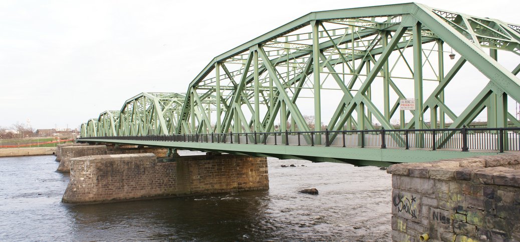
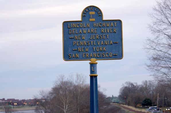
This is actually one of the nicest urban walks you can imagine (except for a little stretch through the the Kafka-esque surface parking lots for State workers). It’s about 2.7 miles, and for most of it you can look out on the Delaware River. You will cross two bridges, and check out some of the best sights Trenton has to offer, including the Capitol, the Old Barracks, the downtown revival on Warren Street, and much more.
Click on the link below to download one of our Geospatial PDF maps. If you follow these instructions you can install this PDF on your smartphone, and it will show you where you are on the walk. Or you can just print the map, as you can any pdf.
Levee WalkGR
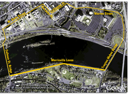
On the PA side, you’ll be walking on a footpath along the top of the levee. You can cut over immediately after you cross the bridge. I normally do Trenton Makes first, and return via the Calhoun Street bridge, but it doesn’t really matter.
The Levees were built during the depression by the WPA, and need repair, especially with the frequent flooding global warming seems to be inflicting on the Delaware. But it’s a great walk!
This is basically a flat walk, making it suitable for beginners. But it’s so beautiful, anyone with an interest in Trenton will want to do it at least once.


Two very enthusiastic thumbs up! You can also stop in at the New Jersey State Museum, near the Capitol building.
We took this walk on a beautiful Sunday afternoon in November! Thanks for letting us know about it!