Open year round (public roads); though parking at Prallsville Mill may compete with events there
(609) 397-3586 Website Google Maps
Gravitas: ![]() RDB:
RDB: ![]() Proximity:
Proximity:![]()
Note: this is a favorite road-ride, but it is NOT for a beginner or the out of shape. It starts with a 6-mile climb, and includes several descents down steep hills ending in sharp turns. Make sure your bicycle, and especially your brakes, are properly tuned, and be realistic about your own riding skills and fitness level.
Cycling out of the Delaware Valley into the rolling countryside surrounding Stockton and Sergeantsville, you could be forgiven for thinking you’d been beamed up to Vermont. It’s truly special.
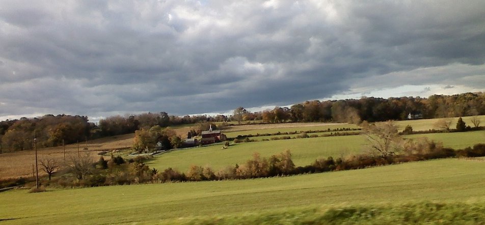 How special was brought home to me during a recent election season. One mayoral candidate had put up a poster bearing the slogan, “Keeping Sergeantsville EXACTLY the way it is!” On principle, this seems like dubious politics, but you will have enormous empathy for the emotions underlying this position if you take this ride. Certainly, almost any change would likely be for the worse.
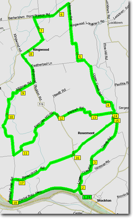
I’m very proud of this route, which I scoped out myself. This is NOT a route for a novice rider. If you ride it all, it’s about 25 miles, and quite hilly. It starts and ends at waypoint 1/19, the Prallsville Mill, on Rte. 29 just north of Stockton center. Unless there’s a special event at the Mill, there’s ample free parking there. In theory, you don’t need to drive up at all. You could ride along the D&R canal from Trenton, and pick up this ride from the canal, but that adds another 40 miles round trip, which would be a lot for anyone but an extremely serious cyclist.
Two great things about this route are:
- It starts at the lowest point. So at any stage, if you have to cut the ride short, it’s mostly downhill back to the car. Great if you’re cramping up, having mechanical difficulties, or just dealing with a change in the weather. However, be warned that from the start, until waypoint 7, the route is almost entirely UP hill, at times quite steep. The good news is that the first couple of miles, while uphill, are a pretty gentle grade.
- The ride loops on itself several times, which again makes it easy to cut short for riders of different abilities. Note, for example, you can ride directly from waypoint 3 to 16. This makes for a moderate 10 mile ride. Or you can cut out about 8 miles (and two very steep up hill climbs) by riding through from waypoint 10 to 18. Similarly you can short cut 5-9, 12-16, or even 12-1.
BTW, the map shows the final leg of the ride (waypoint 18-19) along Rte. 29. It’s OK, with a decent shoulder and fairly good pavement, but it gets a lot of traffic. If you’re riding anything other than an out and out racing bike, you’ll probably want to take the D&R canal towpath instead. It is possible to scramble onto the towpath from an “unofficial” access point at Federal Twist Rd. Or, you can head west about a tenth of a mile for an official access point, where you can easily ride on, then turn east on the towpath to get back to the Prallsville Mill.
_______________
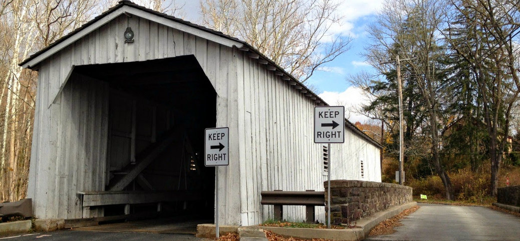
Thanks to http://calypsointhecountry.blogspot.com/ for the covered bridge image!



Did it…top of the hill kicked my butt….pushed on then enjoyed the ride
Congrats!
Had to rest
Thanks…gonna do it…
So don’t do the whole 25 miles!
25 miles is intense. But it’s really close to where I live.
I don’t know if these dates are right for this year (probably not) but you can take a tour of art studios around the Sergeantsville covered bridge in November: http://www.coveredbridgeartisans.com/
Sounds like a great route. When my wife and in town we are going to try it. Thanks for putting it together.