Open year round, public roads
Google Maps Map PDF
Gravitas: ![]() RDB:
RDB: ![]() Proximity:
Proximity:![]()
The goal was to find an outstanding road cycling route as close as possible to Trenton. Cycling from Stockton is still my favorite (see Cycling in Vermont, err…NJ?) but it’s a 45 minute drive from Mill Hill. That means I’m into the ride for 90 minutes before mounting my bicycle: it’s just not feasible much of the time. The West Trenton Ramble is fine, and very close, but some of the roads are busier than I like, or lined by ugly tract homes. If I lived in Cadwalader Heights, and could ride straight from my garage, I might be tempted more. But I live in Mill Hill, and have to throw the bike on a rack and drive for 10 minutes anyway. So, I wondered if I could find a 20+ mile ride that would be reasonably close, and yet where virtually all of the roads met stringent standards for aesthetics and low auto traffic density.
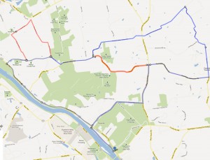
This ride is the result, and may be the perfect compromise between beauty and driving time (click on image to enlarge map) (Click here to download a map PDF).
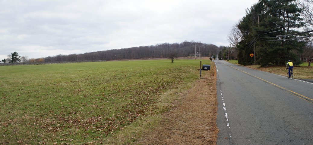
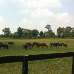
It’s only 20 minutes away: starting at the Delaware and Raritan Canal Park parking lot next to the Washington Crossing bridge. With an extension, it’s about 21 miles (or you can cut it to around 12 miles with a short cut – marked in red – along Pleasant Valley Rd and skipping the extension, also marked in red). Virtually all of the roads get very little traffic. None are ugly, some are downright bucolic with gorgeous horse farms and extended views.
This is a great training ride. Or, if you want to make it a full day out, you can combine it with visits to Washington Crossing Park and Goat Hill. You could also hang a right on the canal tow path and head up towards Lambertville, for a gentrified lunch or supper.
A few caveats:
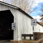
- The route follows River Drive between the parking lot and Church Rd. There’s a bridge closed to automobile traffic; however you can walk your bike across readily.
- The busiest road on the whole route is the stretch of Bear Tavern Rd, which runs about a mile north from the intersection with Church Rd. to the Pennington-Harbourton Rd. Now it’s not all that busy (I counted 11 cars pass me heading north on this stretch on a Monday afternoon around 1 PM – with roughly the same number of cars heading south). Moreover, the road has a nice wide shoulder. So I deemed it acceptable.
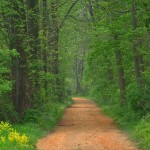
- To me, the nicest stretch of the ride is the northern part, from Poor Farm Rd pretty much all the way back down to the Delaware. It’s quite hilly here (the toughest hill being the stretch of Poor Farm Rd up to the intersection with Harbourton-Woodsville Rd). If you take the short cut, you do save 5 miles, though you still get a pretty good hill to climb. Of course, you miss some of the nicest scenery.
- The route bears right from Pleasant Valley road, to follow Valley Rd down to the Intersection with 29. There’s an entrance to the canal tow path there, allowing you to avoid riding along Rte. 29 for the final 2.5 miles. If you miss the right turn onto Valley Rd, and stay on Pleasant Valley Rd, you’ll end up on 29, but where the tow path is inaccessible. That means you need to ride back along 29 to Church Rd, which is a truly yucky experience. Try not to miss the Valley Rd turn, which wasn’t very well marked (the street sign was missing when I rode it recently). While I’m not a big fan of the tow path, this section is hard-packed and well maintained. I had no problem riding it on a full-bore road bike with 23 mm tires, and it’s infinitely preferable to riding this stretch of 29.


Sounds like a nice ride. But the page shows a link to your old “Canal Cycling Jaunt” piece – that needs to be either taken down or seriously updated – since the nice (paved!) extension from Mulberry Street into town that was completed a few years ago makes the later section obsolete.
Thanks Anne. We have been meaning to fix that post now that the extension is there
Gr8 route. Thanks.